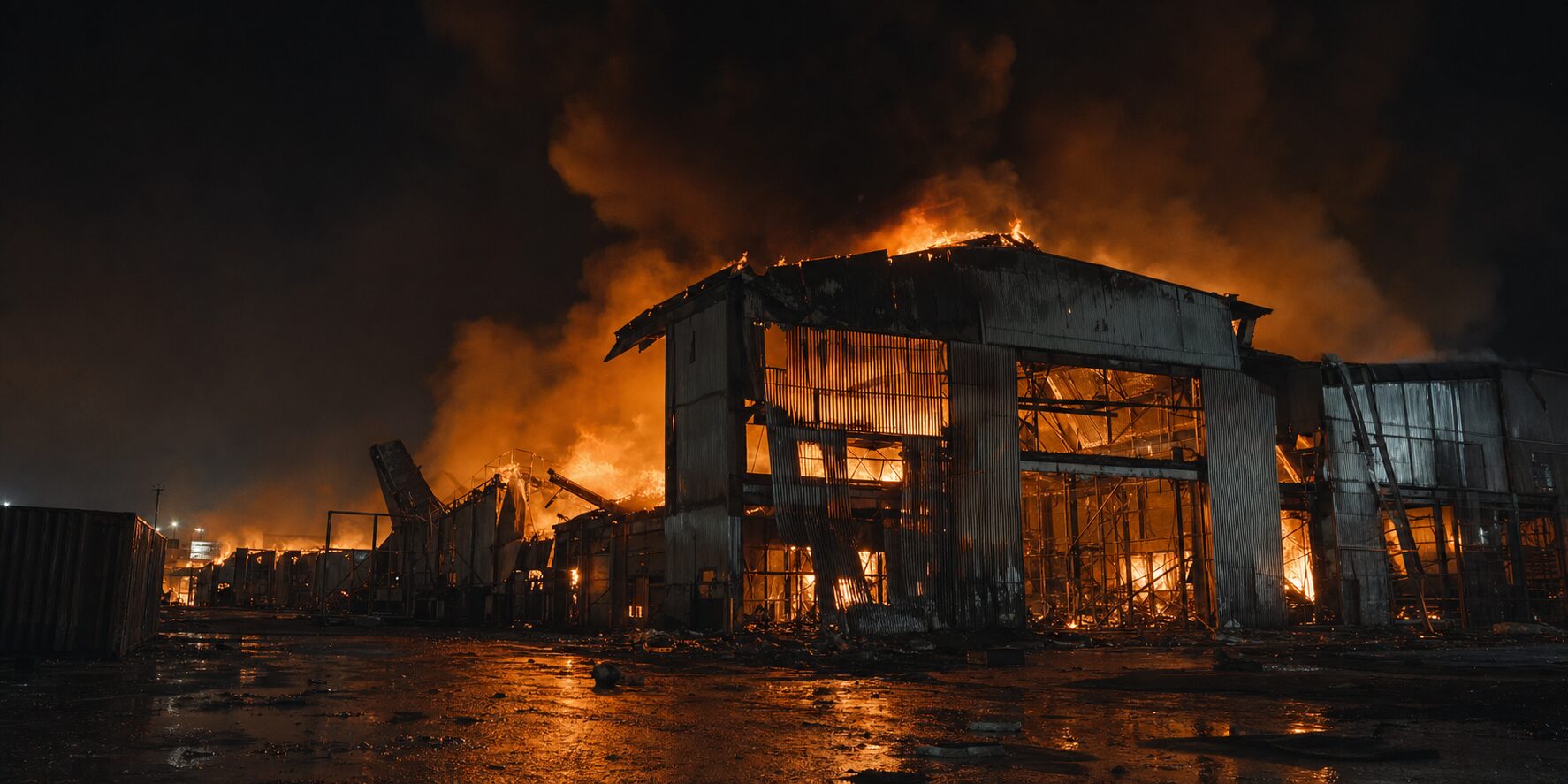
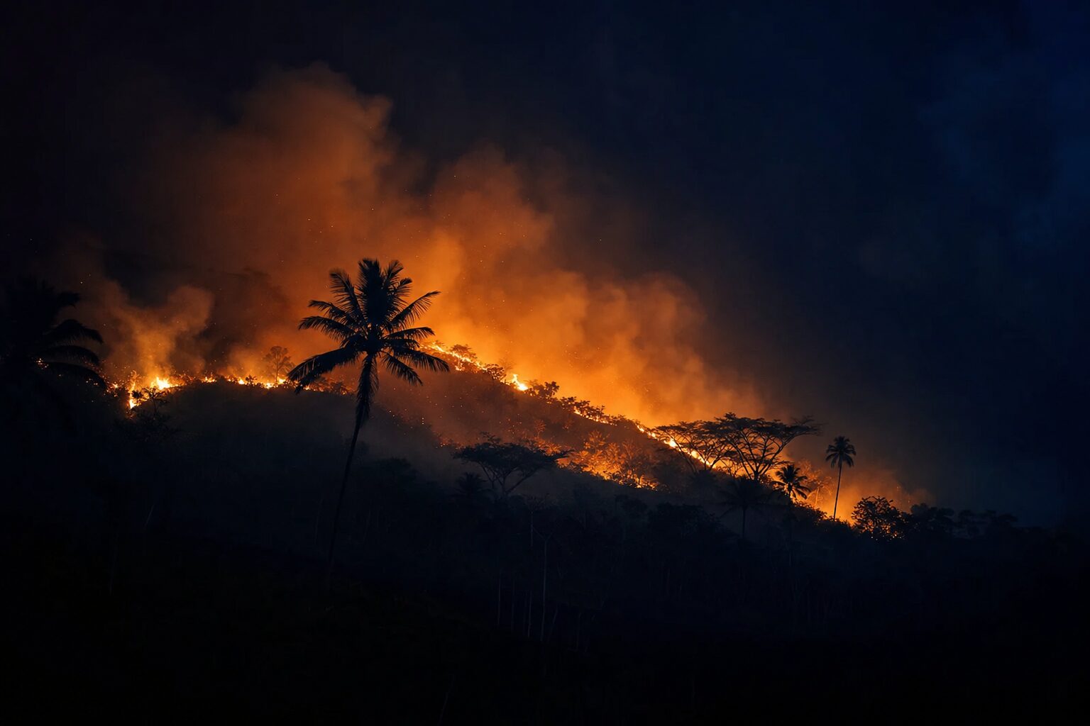
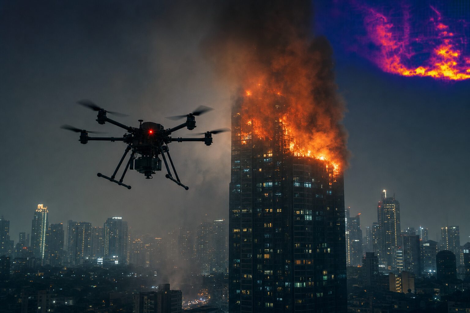
REMOTELY PILOTED AERIAL FIRE RESPONSE FOR THE PHILIPPINES.
An RPAS division built to reach the floors ladders can't, respond in conditions trucks can't, and protect lives no insurance policy can replace — engineered to deploy alongside the Bureau of Fire Protection, MMDA, LGUs, and private industrial operators.
Who We Are
Skyline Drones is a Manila-based aerial robotics company best known for autonomous building facade cleaning. The same operational discipline that scales drones up the sides of 55-storey towers now powers a second division: a dedicated Firefighting RPAS capability built for the unique geography of the Philippines.
Our firefighting platform is designed to integrate with — not replace — the Bureau of Fire Protection, MDRRMC, MMDA, LGU response units, and private industrial fire brigades. Where ladders end, where staircases collapse, where smoke blinds, we extend the reach of every responder on the ground.
This is not a hobbyist quadcopter with a hose attached. It is a tested aerial fire-response system, operated by Civil Aviation Authority of the Philippines (CAAP)-registered Remote Pilots in Command, designed around the realities of high-density Manila, vertical informal settlements, and industrial corridors from Bataan to Batangas.
From the upper floors of BGC towers to the alleyways of Tondo, from refinery flare zones to provincial brushfires — our system is configured for the scenarios Philippine firefighters actually face, not the ones that look good on a brochure. It deploys alongside existing BFP equipment, hydrants, and command structures — augmenting capability without disrupting protocol.
The Doctrine
Fire trucks and articulated platforms cap out at roughly 10 storeys. Our aerial system operates up to 160 metres — extending suppression and reconnaissance to the floors where modern Philippine high-rises actually burn.
Narrow alleyways, blocked access roads, dense informal settlements, refineries with restricted ground approach, bridges over water — our drones fly the routes ground vehicles cannot navigate, day or night, in challenging visibility.
Zero firefighters at altitude. Zero civilians inside the structure during initial reconnaissance. Every minute we shorten the assessment phase is a minute returned to evacuation, containment, and life safety.
Mission Profiles
From vertical residential towers to brushland ridge fires — one airframe family, configured for the mission. Each profile below maps to a documented response playbook integrated with BFP and LGU command protocols.
The Challenge
Conventional fire ladders in the Philippines top out at roughly 30 metres — about 10 storeys. Manila now has hundreds of residential and commercial towers above that line. When a fire breaks out on the 25th floor of a BGC tower, the ladder is a spectator.
Tondo, Payatas, Quiapo, the riverside barangays — the country's most fire-vulnerable communities sit behind alleyways too narrow for any fire truck. By the time hoses are dragged in by hand, the fire has spread three structures over.
The Bureau of Fire Protection consistently ranks among the most dangerous occupations in the country. Every burning roof, every weakened staircase, every chemical container is a fatality risk. Aerial response moves those first minutes to a position where no human is exposed.
Platform Specifications
Operates at heights that exceed every fire ladder deployed in the Philippines today — covering the full residential and commercial high-rise envelope of Metro Manila.
Continuous-flow suppression via tethered water/foam supply from BFP truck or municipal hydrant. Recon airframes rotate through hot-swap battery cycles for indefinite over-watch.
Dual-payload thermal and 4K optical sensors locate trapped occupants through smoke, identify structural hot spots, and stream live intelligence to the Incident Commander.
Simultaneous reconnaissance, suppression, and over-watch from coordinated airframes — managed by a single Remote Pilot in Command from a forward operating ground station.
Designed around the fittings, pressures, and operational tempo of Bureau of Fire Protection equipment. No bespoke infrastructure required — connect, deploy, suppress.
Encrypted command-and-control link, optional live feed to BFP / MDRRMC / LGU command posts, and recorded mission data for post-incident review and insurance documentation.
Operational Sequence
Activation request received from BFP, LGU, or contracted private operator. Crew, ground station, and airframes mobilised within minutes.
First airframe launches on arrival — thermal and optical sweep delivers live structural picture to Incident Commander before any responder enters.
Suppression airframe couples to BFP truck pump or nearest municipal hydrant via certified high-pressure feed line.
Targeted water or foam delivery directly to seat of fire — at altitude, behind windows, through openings inaccessible from the ground.
Full mission record — flight data, thermal imagery, suppression cycle — delivered to command for after-action review, BFP filing, and insurance.
How We Work With You
From equipment to training to ongoing support — every engagement includes the capabilities you need to stand up and sustain an aerial fire-response programme.
Outright acquisition of Skyline firefighting RPAS systems for BFP units, LGUs, industrial operators, or private fire brigades. Configured to your jurisdiction, terrain, and asset risk profile.
End-to-end programme to stand up an aerial fire-response capability inside your organisation — from CAAP RPIC certification of your operators to integration with existing dispatch and command protocols.
Ongoing airworthiness, depot-level repair, software updates, and surge support — keeping your fleet mission-capable across the rainy season and beyond.
Capability Comparison
| Capability | Skyline RPAS | Fire Trucks & Ladders |
|---|---|---|
| Vertical Reach | Up to 160 metres / 55 storeys | ~30 metres / 10 storeys |
| Access | Alleys, rooftops, water, restricted zones | Paved roads & cleared approaches only |
| Setup Time | Airborne within minutes of arrival | Ladder rigging & positioning required |
| Risk to Personnel | Zero firefighters at altitude | Crews working at height & inside structure |
| Recon Capability | Live thermal & optical to command post | Visual estimate from ground level |
| Night / Smoke Operations | Thermal-imaging native | Severely limited visibility |
| Documentation | Full flight & mission data recorded | Manual incident report only |
Safety & Compliance
Every mission is flown by a CAAP-certified Remote Pilot in Command, with a co-pilot or visual observer on every high-complexity sortie.
Airframes registered with the Civil Aviation Authority of the Philippines and flown under approved operational concepts.
Standard operating procedures developed with — and aligned to — Bureau of Fire Protection command structure.
Mission requests routed through LGU and Municipal Disaster Risk Reduction and Management Council channels where applicable.
Encrypted command link, optional live mission feed to BFP, MMDA, MDRRMC, and private operator command posts.
Comprehensive third-party liability and hull cover on every airframe, every mission — documentation provided pre-deployment.
Capability Briefing
For BFP units, LGUs, MMDA, MDRRMC councils, refinery operators, port authorities, and private industrial fire brigades — request a closed-door briefing on aerial fire-response capability tailored to your jurisdiction or asset.